
The Best Hikes and Walks Near Brisbane
If you’re looking for a fun weekend activity that isn’t Netflix and ice cream, then check out some of the best places for hiking close to Brisbane. Want a leisurely stroll or to work up a sweat while seeing Brisbane’s most breathtaking scenery? We’ve got you covered! There’s something for everyone, whether you’re a beginner hiker or an experienced mountaineer.
Glasshouse Mountains
The five mountains that make up the well-known Glass House Mountains are all spectacular; the majority of them offer substantial trekking opportunities for anyone with intermediate to very advanced bushwalking abilities. It’s ideal for a day trip because it’s only one hour’s drive north of Brisbane. How can you see the Glasshouse Mountains at their best? Obviously, climb one of them. Each mountain summit has a different entrance point, so come prepared. Even if they all have advantages, Mount Ngungun should be added to the list of places to hike in Queensland. Your time at Ngungun will give you unobstructed views of the surrounding mountains and while any time is a fantastic time to climb, you cannot pass up a sunrise at the top. The round trek takes around two hours. Visit the Tibrogargan Trailhead, Mt. Beerwah View, and Mt. Beerburrum Summit Walk for intermediate hikes. Advanced hikers can attempt the Mt. Ngungun Summit Walk. Avoid the Yul-yan-man Track unless you are a very skilled bushwalker with specialised knowledge of navigation and emergency first aid.

Mt Coot-tha
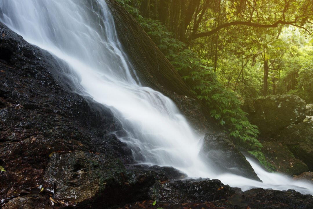
The Mt. Coot-tha walking trails are another great option close to home. The Brisbane CBD is about 7 km away, and there are numerous walking trails to choose from. It’s best to park at the JC Slaughter Falls Picnic Area and take the Summit Track for an uncomplicated walk up to the Mt Coot-tha Summit Lookout for stunning views of the city and surrounds. Take the Mahogany Trail down to get something a bit more challenging. The trails include an Aboriginal art trail, a gushing waterfall (on a good rainy day), and breathtaking city views from the summit. Many locals use the trails only for fitness, but sunset is one of their favourite times of day while the sun creates beautiful colours in the sky.
Mt Tamborine / Tamborine National Park
Both Brisbane and the Gold Coast are only an hour away from Mt. Tamborine. Numerous hikes are available, and all offer breathtaking views of the national parks in the Scenic Rim to the west and the ocean and skyscrapers of the Gold Coast to the east. Tamborine Mountain, which is aptly nicknamed “the green behind the gold,” has a plethora of amazing excursions and hikes screaming to be explored on foot. This national park has walking trails in six different areas. The majority of these treks are short and quite straightforward, making them excellent for novices, but you may come across a few small steep stretches. The Curtis Falls Track allows you to see the falls from the bottom, while the Cedar Creek Tracks are especially popular for swimming. Experience the rainforest from above with the Tamborine Rainforest Skywalk for a distinctive viewpoint. Any time of year is an excellent time to visit. From the easy hikes at Witches Falls and Sandy Creek Circuit to the stunning Palm Grove Rainforest Circuit there’s something for everyone. These walkways are ideal for the more leisurely pedestrian, with subtropical palms, intimidating big strangler figs, and lookout locations that seem to be around every corner.
Lamington National Park
Lamington National Park is home to a collection of breathtaking natural splendours that should be at the top of everyone’s bucket list, even though it is a little further from Brisbane. The Morans Falls route, which winds through multiple levels of volcanic lava flows and a subtropical rainforest before culminating with breathtaking vistas of Morans Falls and the surrounding valley, easily wins the award for finest bushwalk close to Brisbane. You’ll undoubtedly see photos from this journey on your Instagram feed. Rainforests, rivers, waterfalls, spectacular views, and other natural splendour abound in the Lamington National Park. It is worth the two-hour drive from Brisbane in our view! This national park is divided into two sections: the Green Mountains and Binna Burra, both of which offer half- or full-day hikes. Both the beginner-friendly and more difficult circuits in the Lamington National Park are on offer for hikers. The easy Centenary Track or Python Rock Track from the Green Mountains and the more difficult Rainforest Circuit or Caves Circuit from Binna Burra are two favourites for a half-day hike.
Mt Barney

The Mt Barney National Park includes Mt Maroon, Mt May, Mt Lindesay, Mt Ernest, Mt Ballow, Mt Clunie and Mt Barney, the second-highest peak in south-east Queensland. You’ll want to head there for the best climbs. There are four primary tracks you can choose from, though be warned; they all advise prior bushwalking knowledge. Although Cronan Creek Falls and the Upper Portals Track are equally excellent walks, the Lower Portals Track is the most well-known. Go for the Yellow Pinch Lookout if you like something shorter. The Lower Portals of Mount Barney can be reached after a three-hour roundtrip hike along a rugged trail. The lakes at the conclusion of the climb are stunning, and the hike itself is beautiful! Granite boulders frame the pools on each side and it’s a great location for a summer swim. You can camp nearby if you arrange for a permit ahead of time.
Springwood Conservation Park
In the centre of suburban Brisbane, a hidden woodland paradise has been created on what was formerly a quarry site. The region is home to koalas and sugar gliders, as well as cliffs, caves, a canyon, and rocks perilously placed atop one another. Try the 570-meter-long Stringybark Lookout trail or the 1.45-kilometre-long Gorge Discover Circuit, which will take you to and from the gorge. Just be ready to test your legs and buns on a lung-burning flight of steps.
Springbrook National Park
This national park, located 100 kilometres south of Brisbane, is home to numerous waterfalls, a thick rainforest, old trees, and breathtaking views. Springbrook, Mt. Cougal, Natural Bridge, and Numinbah are its four divisions. There are many different trails in Springbrook National Park, including the well-known Natural Bridge Circuit (about an hour’s walk), which features some of the most beautiful waterfalls you’ll ever see and even glow worms at night. For those who are a little more serious, the 14-kilometre Warrie Circuit will take you through the jungle, across creeks and gullies, and up the western side of the canyon in around six hours total.
This park offers a variety of hikes that range in length from 200 metres to 54 kilometres. Try the Goomoolahra Falls Lookout Track, which is more of a stroll than a walk if you’re searching for something extremely simple. The Natural Bridges Circuit and the Lord of the Rings-inspired Best of All Lookout Track are two moderate treks. Try the Purling Brook Falls Circuit, which continues on to the Warringa Pools, for something more difficult that could end in a swim, or take on the Twin Falls Circuit (two hours), which takes you past two waterfalls and has been rated the best short walk in south-east Queensland.
Kondalilla National Park
103 kilometres north of Brisbane, Kondalilla National Park is located just behind the Sunshine Coast and is a great option for day hikes. It is most known for the Kondalilla Falls, which plunge 90 metres into a valley of rainforest. There are many native wildlife in the Kondalilla Falls region, including wallabies, platypus, goannas, and numerous frog and bird species. You can visit this area of the Blackall Ranges to explore meandering wooden paths and towering trees that look like they belong in prehistoric times. Consider taking a quick swim to cool off at the 4.7 km Kondalilla Falls Circuit, which has over 300 steps and goes by the freshwater rock pools of Skene Creek. It’s undoubtedly the most well-known trek, but be aware that you’ll need to walk back up the 300 stairs down to the bottom. Try the Picnic Creek Circuit, which will give you spectacular views of the valley, for something a little simpler.
D’Aguilar National Park
D’Aguilar National Park, which is located between 10 and 35 kilometres north-west of Brisbane’s downtown, is a little closer to home. A breathtaking view of Moreton Bay, waterfalls, canyons, gorges, subtropical rainforest, and eucalyptus trees can be seen here. There are numerous treks in this national park, and depending on your skills and experience, the D’Aguilar National Park offers a variety of paths that range from easy to difficult. Try the 1.9km Rainforest Circuit if you’re not sure where to begin; it is a short and simple hike for the most part. The Morelia Walking Track is excellent for those seeking a more challenging activity; it is generally gently sloping but can occasionally get steep.
Mt Coolum
This location is ideal if you want to see the water. Prepare to make some space on the insta grid because the view is amazing! Halfway between Noosa and Caloundra, you can go for a morning hike and then immediately hit the beach to cool off. This one is only for experienced hikers because there is just one track that leads directly to the summit. The Mt. Coolum Summit Walk has some naturally occurring rock stairs, and some of the terrain is steep, rocky, and covered in loose gravel.
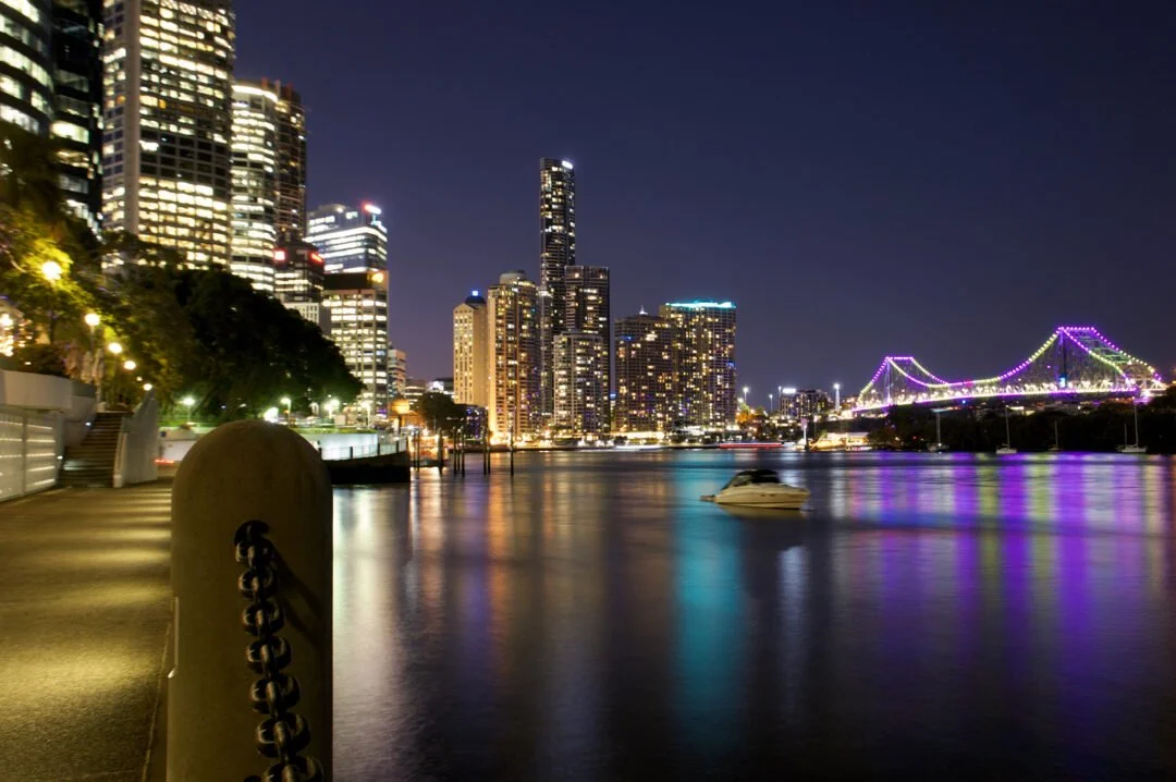
Brisbane Riverwalk
One of Brisbane’s most famous and stunning walks, the Brisbane Riverwalk, is, in our opinion, a must-do. You will be walking on water since the majority of its route is suspended above the river (or as close to this as possible). If you wish to go any further, you can take this track all the way to Toowong from New Farm and Howard Smith Wharves, which is followed by the Brisbane CBD.
John Oxley Riverwalk
This walk will be most handy for you if you are a student at the university because it winds around the campus, making it ideal for a study break walk before or after class. It’s a simple stroll because the road is flat and made of gravel. This route passes by the Eleanor Schonell Bridge, which you should visit if you want to extend your walk or get a lovely perspective of the river.
Kangaroo Point
Kangaroo Point is well renowned for its scenery and the terrifying cliff steps, but it also makes for an amazing walk, particularly if you time it for sunset when everything is candy-hued and starting to light up for the night. You can stroll around the top, climb the stairs, or descend to the base of the cliffs, where a boardwalk leads you along the river.
Bunyaville Regional Park
Bunyaville is one of the best places for walking, horseback riding, and cycling and is only 15 kilometres northwest of the city of Brisbane. The longer Bunyaville Track, which is 1.6 km roundtrip and only takes 30 minutes, is one of two walking trails that can be accessible from the day use area. The shared use trails with bikers and horseback riders can be explored by the more daring.
Moggill Regional Park
Moggill Conservation Park is a 500ha expanse of pristine wilderness that is a part of a bushland corridor that runs as far north as the D’Aguilar range. Leave the car at the end of Chalcot Rd and head out to explore. The Devils Break Loop should take around three hours, and the park is well marked. This trail is not only scenic but dog-friendly, so put your four-legged pal on a leash and head out together.
Brisbane Koala Bushlands
An accessible bush walk, the Stockyard Creek Circuit in Burbank is a great option for families with young children. The entry is situated off Alperton Road in Burbank and is a part of the Brisbane Koala Bushland, which spans from Belmont to Burbank. A tourist area with picnic tables, electric grills, restrooms, and a fascinating, interactive information activity where kids may hear about a variety of bush species are all located here. Before crossing the creek, which is rarely dry, even in drought, the 1.4 km walking pathway winds through an open eucalyptus grove and takes less than 50 minutes to finish. An observation platform is located over the stream, and from there, you might be able to watch a variety of frog species, long-necked turtles, or eastern water dragons relaxing on rocks. Koalas are difficult to notice in the wild, so keep a watch out for them. To provide these beloved local species with a secure sanctuary, a network of surrounding parks has been developed. Wheelchairs and strollers are both ideal for this flat walking path, and it is also dog-friendly, just keep your pet on a leash at all times!
Get out and explore
Not in Queensland? Check out our favourite hikes in Sydney & NSW and best walking trails in and around Melbourne & VIC.
If you’re a GoGet member, then there’s nothing standing in your way! Book a car today and stretch those legs on one of these great hikes. No Membership? No problem! We’ve got the perfect plan for you!